Africa
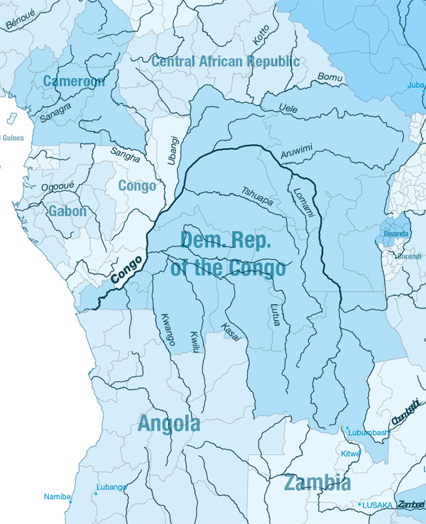
The Congo
Gallery
Length:
4700km
Navigability:
Until Matadi (Livingstone waterfall)
Countries crossed:
Democratic Republic of the Congo and the Republic of the Congo
Inland navigation authority:
Commission Internationale du Bassin Congo-Oubangui-Sangha (Cameroun, Democratic Republic of the Congo, Republic of the Congo) http://www.cicos.info/siteweb/
Main goods transported:
Coal, copper, containers, palm oil, sugar, coffee and cotton fuel, wood, minerals and agricultural products.
Facts of importance:
The Congo River remains Central Africa’s most vital navigational system. Barges carry and are a communication and transportation resource for those areas that are not served by roads. Although certain sections of the river can be used for transportation, it is unnavigable in its lower reaches, where there are numerous waterfalls.
An agreement establishing a Uniform framework for the river system and creating CICOS has been signed on 6 November 1999 by the 4 Heads of State of Cameroon, Central Africa, Congo and Democratic Republic of Congo (Angola is now observer). An increasing number of other countries are now also declaring an interest in using the water resources of the Congo Basin. Indeed, the congo river represents the biggest hydropower potential in the world (44 000 MW).
Main challenges for the future :
- -Climate change : The basin faces severe low-water, about 200 days /year ar not navigable anymore since 2002 whereas only 4 days/year until 1970
- -Lack of cooperation and funds provided by the riparian countries
- -Renewal of infrastructures
- -Aging crews
